With the recent refit, all of systems on Dorade were upgraded. These upgrades include state-of-the-art navigational, weather and communications capabilities. Dorade now has on-board the navigational, weather and communications capabilities normally found in a modern ocean racing boat. Jim Thompson of Island Yacht Services has worked hard to make this happen.
This is a long way from when Dorade first sailed the Atlantic with only an 8 volt battery to power the compass light.
These upgrades to navigational, weather and communications capabilities include:
Twin B & G Zeus 12″ Multi-Function Chart Plotter Displays with Navionics Platinum Plus Charts software. Platinum Plus has 3d and photo overlay capabilities. When viewing a chart, you can choose between 2d, 3d, Photo overlay land only, photo ovelay shallow water and land, or photo overlay all. The charts also can orient theselves in the 3d mode to take on the helmsmans perspective. With 3d and photo overlay, you see on the plotter basically what you would see from the helm.
B & G Hydra 2000 Wind, Sea Temp, Depth, Boat Speed Data. This actually is one of the systems preserved from before the refit and re-intergrated with the new nema onboard network.
Garmin Handheld GPS 76Cx as back up.
ICOM 504 VHF radio with DSC and remote full function helm command mic.
3 ICOM M34 VHF hand held radios
ACR GlobalFix iPRO 406 MHz GPS EPIRB
Inmarsat FleetBroadband – KVH fleet broadband 150 Satellite Phone.
Inmarsat FleetBroadband – KVH Boadband Internet enabling communication and data transfer via the internet when offshore.
B & G Broadband 3G Radar. Broadband radar works with a sine wave rather than a pulse. This accomplishes two things; low power draw, and the abilility to see objects very close. It is also not harmful to humans. Very clear radar imagery within yards of the boat. The chart plotters can show the radar screen alone or overlayed on a chart page. If you look closely at photo 5 you can see in the radar the entrance to the basin at LMI. Between the center of the screen and the entrance is Joe’s boat CARINA moored less than 50 yards away (red blip). Also notice the white triangles that represent AIS signals from other yachts docked nearby. This is at a range of 1/8th mile.
Panasonic Wireless Tablet and Toughbook with Expedition software. This will act as the ships computer for downoading weather data, and communication. Grib files can be transfered into the plotters for animation. The expedition software in the laptop will take weather files and create routing suggestions. Expedition is a racing program that works with the boats nema 2000 network. This program takes info from the gps and wind instruments to assist with strategic and tactical decision making.
The above plotters, radar and laptop all recieve information from the class A AIS transciever. AIS data is displayed from other vessels helping determine their cog, sog, cpa, time to cpa, as well as their size and destination. In addition DORADE sends this info out to other vessels about herself.
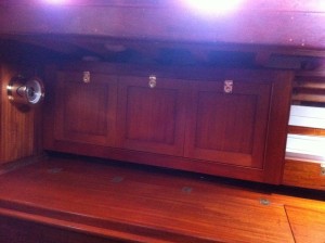
Of course all these displays are hidden when not in use behind beautiful raised panel doors. This to preserve the appearance of the interior when not in sailing or racing mode.
We are looking for the best plan as far as back up offshore communications. The sysyems being considered are HF radio, Single Side Band, and portable satphone. Please post comments or suggestions.


